|
|
|
Paull Village Enhancement Scheme - IntroductionThe village of Paull is uniquely situated on the north bank of the Humber estuary. It occupies a position of significant natural beauty and the village has been designated as a conservation area. In close proximity to the estuary it is at constant risk from flooding. The Environment Agency has undertaken major flood defence work to the village, comprising of a substantial flood wall in the village itself plus rock armour banks to the north of the village, up to and including the Saltend chemical works. | 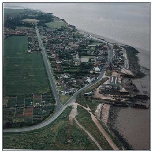 Photograph by Gary Banks; reproduced by kind permission of BP Amoco Chemicals | The third phase of this ongoing programme of flood defence involves plans for a managed retreat of the shoreline to the south of the village to incorporate earth banks and flooded saltmarsh and mudflats. |
| |
|
*SSSI = Site of Special Scientific Interest; Ramsar refers to those specific wetland sites designated as being of international importance by the Ramsar Convention (signed in Ramsar, Iran.) | |