|
|
|
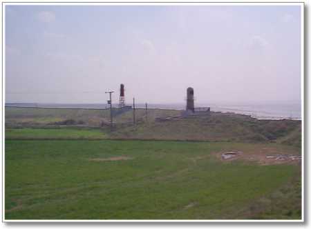 |
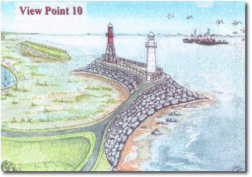
The tour is almost complete. This view is of the two
navigational lighthouses beyond which the managed retreat of the shoreline
will begin. It is envisaged that these will remain on a rock-armoured
peninsula, shown in the impression below with only a footpath access
although vehicle access may be necessary. |
|
|
The preferred option is that the breached land area will incorporate some constantly flooded lagoon areas, and possibly within those, islands to be naturalised by a diverse range of indigenous flora and fauna. We see this area integrated with new woodland to form a new nature reserve including wildlife observation hides and platforms. As such it offers great potential as an educational resource for a wide audience. (For an aerial photograph of the scheme area plus an overall artist's impression, see the next page.) |
 |
|